
FROM THE SKY, THE WHOLE STORY
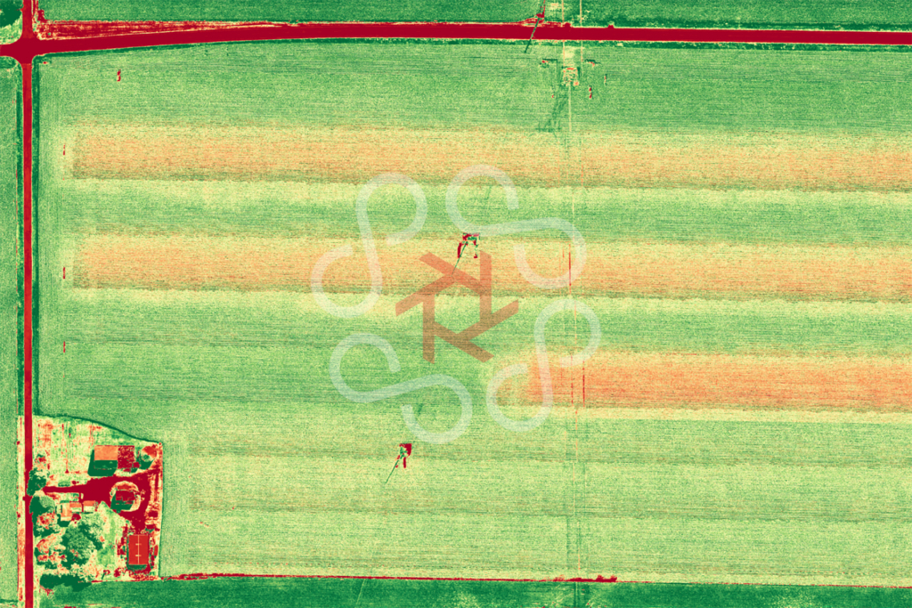
You already walk your fields. You already know your ground. Drone data doesn’t replace that — it extends it, showing you what you can’t see from the cab or the field edge: the drainage pattern developing in the low corner, the emergence gap across a whole zone, the stress showing up days before it’s visible standing in the rows.
I fly repeatable, consistent patterns over your acreage and turn what I capture into something you can actually use — maps and imagery that help you plan inputs, document conditions, and make decisions with your own eyes on the whole field at once.
This isn’t a one-and-done flyover. It’s a season-long record of what your ground is doing.
WHAT YOU GET
 Crop Health & Stand Mapping See emergence, population, and plant health across the entire field — not just the spots you can walk to. Catch the gaps and the stress zones while there’s still time to respond.
 Weed & Drainage Mapping Locate weed pressure and map how water actually moves across your ground — so spray plans and drainage decisions are based on what’s really happening, not a guess from the road.
 Weather-Event Documentation When wind, hail, or flooding hits, timing is everything. Before, during-as-it-recedes, and after imagery gives you a documented record of conditions — so when the insurance conversation comes, the data is already sitting there.
 Yield & Planning Support A visual, season-long history of your field’s patterns — growth, problem zones, and how they change year over year — to inform planning and input decisions.
HOW WE WORK TOGETHER
1. We start with a conversation. I learn your operation — your acreage, your crops, what you’re trying to solve. No canned package.
2. We fly on a schedule that matches the season. Repeatable, consistent flights at the growth stages that matter, plus responsive flights when weather makes them worth it.
3. You get data you can use. Clear maps and imagery, delivered to you — exportable into the tools and platforms you already work with, including integration with major farm-management systems.
4. Year one, we prove it. The first season is about showing you the value on your own ground. The relationship grows from there.
WHY LOCAL MATTERS OUT HERE
Satellite imagery can’t fly the morning after a hail event. A dispatch network doesn’t know your ground or answer the phone when the window’s closing. I’m minutes away, I fly when the weather cooperates, and I’m the same person every single flight — building a record of your field, and a relationship with your operation, that a stranger with a drone never could.
I’m not the cheapest flyover you can find. I’m the one who treats your yield like it’s personal — because out here, it is.
Certified survey or boundary work is referred to our licensed surveyor partners — I keep to what I do best: aerial crop data you can act on.